Emlid Reach RX Lightweight RTK GNSS Receiver

EmlidSKU: RB-Eml-47
Manufacturer #: REACH-RX

Price  :
Sale price ¥394,027

Tax included Shipping calculated at checkout

Stock  :

Re-stocking soon See due date

Notify me when this product is in stock
Maximum 2 lipo products per cart

Payments and Security

American Express Apple Pay Google Pay JCB Mastercard PayPal Shop Pay Visa

Your payment information is processed securely. We do not store credit card details nor have access to your credit card information.

Description
  • Emlid Reach RX Lightweight RTK GNSS Receiver
  • Mobile app
  • Designed specifically for work with NTRIP corrections
  • Lightweight and easy-to-use
  • Multi-band RTK GNSS receiver
  • Communication interface: BLE 4.2
  • Water Resistance: IP68

The Emlid Reach RX Lightweight RTK GNSS Receiver is designed specifically for work with NTRIP corrections. RTK is a technique used to improve the accuracy of a standalone GNSS receiver. Traditional GNSS receivers, like the one in a smartphone, could only determine the position with 2–4 meters (7–13 feet) accuracy. RTK can give you centimeter accuracy.

GNSS receivers measure how long it takes for a signal to travel from a satellite to the receiver. Transmitted signals travel through the ionosphere and atmosphere and are slowed down and perturbed on the way. For example, travel time on a cloudy day and in clear sky conditions would be different. That is why it is difficult for a standalone receiver to precisely determine its position. RTK is a technology that solves this issue.

High real-time precision

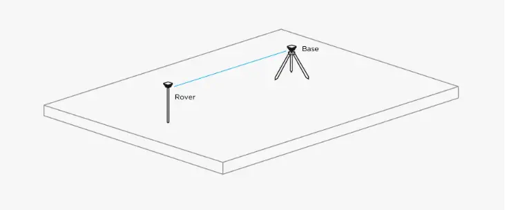
Two receivers are used in RTK. One of them is stationary, another moves freely. They are called base stations and rovers.

The base's mission is to stay in one place and send corrections to a moving receiver. Rover uses that data to achieve a centimeter precise position. Any number of rovers can connect to one base if their input settings match the base's output.

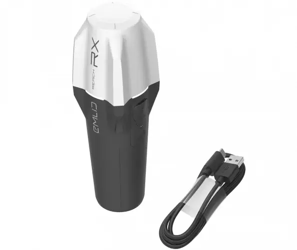
  • 1x Reach RX
  • 1x USB Type-C Cable

Size

  • 172 x 51 x 51 mm

Electrical

  • Autonomy: Up to 16 hrs
  • Battery: Li-Ion 5200 mAh | 3.6 V, 18.72 Wh
  • Charging: USB Type-C, 5V, 2A

Positioning

  • RTKH: 7 mm + 1 ppm | V: 14 mm + 1 ppm
  • Convergence time: ~5 s typically

Connectivity

  • Communication interface: Bluetooth 4.2
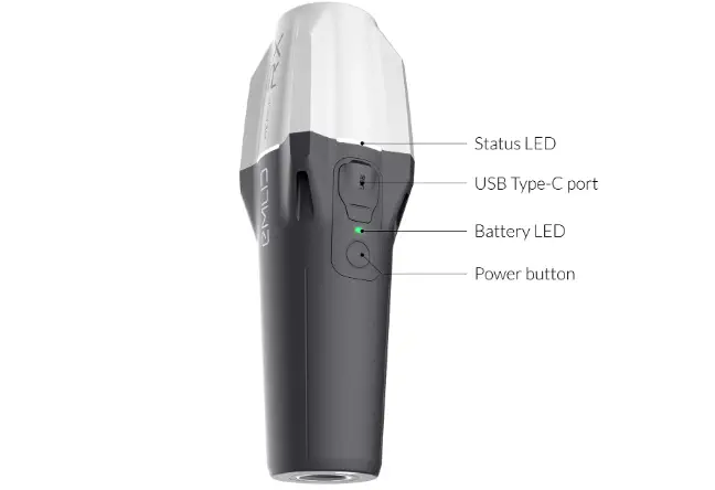
  • Ports: USB Type-C

Data

  • Input data format: RTCM3
  • Input data protoco: NTRIP
  • Position data format: NMEA

GNSS

  • Signal tracked: GPS/QZSS L1C/A, L2C | GLONASS L1OF, L2OF | BeiDou B1I, B2I | Galileo E1-B/C, E5b
  • Number of channels: 184
  • Update rate: 5 Hz

Mechanical

  • Mount: 5/8 inch 11 UNC
  • Operating temprature: -20 °C to +65 °C
  • Ingress protection: IP68 (maximum depth 1.5 m (up to 30 minutes)
  • Weight: 250  g

Estimate shipping

You may also like