


Included in this bundle
- 1 X RB-Rpk-29 - Slamtec RPlidar S3 360° Laser Scanner (40 m)
- 1 X RB-Rpk-42 - Slamtec Slamkit Mapping & Localization Solution (Developer Edition)
Description
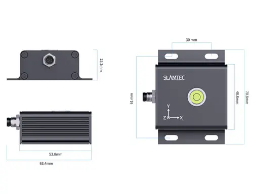
- Slamtec Slamkit & S3 Lidar Mapping & Localization Solution (Developer Edition)
- With Slamtec RPlidar S3 360° Laser Scanner (40 m)
- Precise long-distance sensing and high-definition object detection
- Enhances scalability and stability of mobile robotics
- Provides robust localization in complex environments
- Mapping Area: 150 x 150 m
- Includes comprehensive SDK development kit
The Slamtec Slamkit & S3 Lidar Mapping & Localization Solution (Developer Edition) is the industry's first commercial offering that independently provides mapping and localization functionalities, significantly enhancing the scalability and stability of mobile robotics. This solution can be embedded in a robot’s controller via software licensing, enabling autonomous mapping and localization. It allows for easy customization of robot applications through standardized software interfaces.
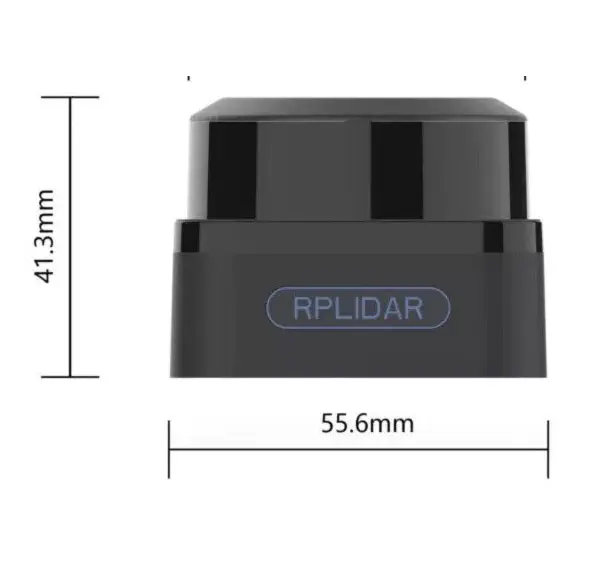
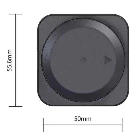
The RPlidar S3 360° Laser Scanner (40 m) is a next-generation low-cost 360-degree 2D laser scanner (LIDAR) solution developed by SLAMTEC. It can take up to 32000 samples of laser ranging per second with high rotation speed. Equipped with contactless power and signal transmission technology, it breaks the life limitation of traditional LIDAR systems to work stably for a long time.
The RPLIDAR S3 is a 2D laser scanner, which can perform a 2D 360-degree scan within a 40-meter range and produce a 2D point cloud map of the space where it is located. The generated 2D point cloud data can be used in mapping, robot localization, robot navigation, and object or environment modeling.
Compared with other RPLIDAR series, RPLIDAR S3 has a more stable performance when detecting objects in long distances, objects in white or black alternatively, and objects under direct sunlight, which is ideal for map building in the outdoor or indoor environment within a 40-meter ranging radius. Therefore, it can be widely applied in many consumer-oriented business scenarios.
The typical scanning frequency of RPLIDAR S3 is 10 Hz (600 rpm). With the 10 Hz scanning frequency, the sample rate is 32KHz, and the angular resolution is 0.1125°. Due to the improvements in SLAMTEC hardware operating performance and related algorithms, RPLIDAR S3 works well in all indoor environments and outdoor environments with direct sunlight. Meanwhile, before leaving the factory, every RPLIDAR S3 has passed strict testing to ensure the laser output power meets the eye-safety standard of IEC-60825 Class 1.
The RPLIDAR S3 comes with a rotation speed detection and adaptive system. The system automatically adjusts the angular resolution according to the rotating speed. And there is no need to provide a complicated power system for the RPLIDAR. In this way, the simple power supply schema saves the BOM cost. If the actual rotation speed of the RPLIDAR is required, the host system can get the related data via the communication interface.
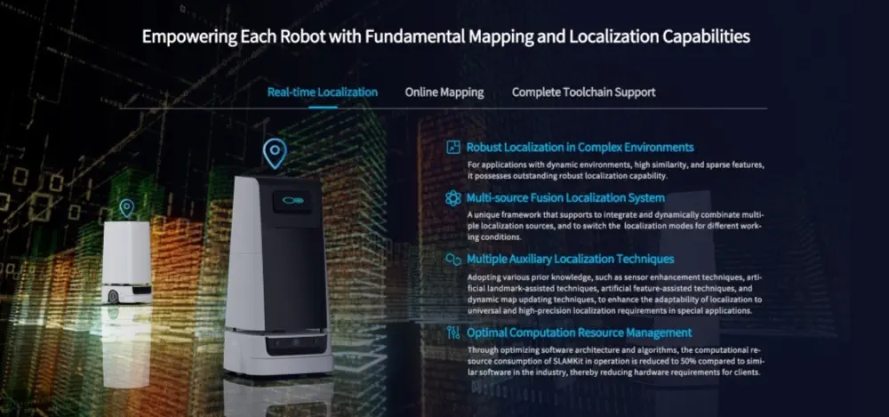
Slamkit offers real-time and robust localization capabilities, even in complex and dynamic environments with high similarity and sparse features. Its multi-source fusion localization system integrates and dynamically combines multiple localization sources, switching modes as needed for different working conditions. Various auxiliary localization techniques, such as sensor enhancement and dynamic map updating, further enhance its adaptability to high-precision localization requirements.
The solution optimizes computational resource management, reducing resource consumption by 50% compared to similar industry software, thereby lowering hardware requirements. It supports a mapping area of up to 150 x 150 m and employs SharpEdge™ map optimization technology to create high-precision maps with an accuracy of 1.5 cm. Automatic and auxiliary loop closure detection strategies ensure higher success rates in mapping, and dynamic parameter adjustment interfaces maintain map quality.
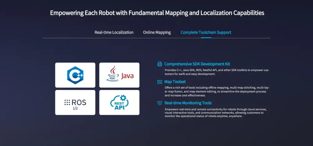
Slamkit includes a comprehensive SDK development kit, offering C++, Java, ROS, Restful API, and other toolkits for swift and easy development. Its map toolset includes offline mapping, multi-map stitching, multi-layer map fusion, and map element editing, streamlining deployment and increasing cost-effectiveness. Real-time monitoring tools enable remote connectivity and operational status monitoring through cloud services and visual interactive tools.
Slamkit supports common controller hardware and systems, including Intel and ARM architectures and Ubuntu systems. The solution abstracts a rich set of software interfaces for various SDK toolkits and provides comprehensive documentation and sample code. It adapts to various scenarios such as household, cleaning, industrial, delivery, and inspection, ensuring stable robot operation through diversified parameter configurations.
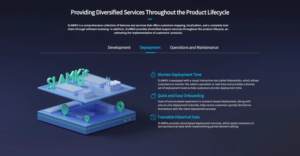
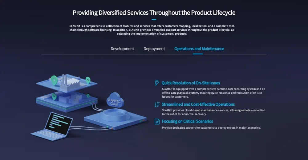
Slamkit offers standardized performance evaluation methods and tools to validate personalized robot products, shortening deployment time with visual interactive tools like Robostudio. It provides cloud-based deployment services for saving historical data and partial element editing. For operations and maintenance, Slamkit includes a runtime data recording system and an offline data playback system for quick issue resolution, along with cloud-based maintenance services for remote recovery.
Note: Ensure proper handling and usage of the software to avoid operational disruptions.
- 1x Slamkit License Card (Developer Edition)
- 1x Slamkit License Software Slamware (Developer Edition)
- 1x Slamtec RPlidar S3 360° Laser Scanner (40 m)
RPlidar S3
- Accuracy: ±30 mm
- Resolution: 10 mm
- Sample Rate: 32 KHz
- Working Wavelength: 895 - 915 nm
- Laser Power: 25 W
- Pulse Length: 5 ns
- Scanning Frequency: Typ. 10 Hz, 10 ~ 20 Hz
- Angular Resolution: Typ. 0.1125°, 0.1125° ~ 0.225°
- Communication Interface: TTL, UART
- Communication Speed: 1M
- Scan Field Flatness: 0° - 1.5° (other angle requirements can be customized)
- Distance Range: White object: 0.05-40 m (under 70% reflection) | Black object: 0.05-15 m (under 10% reflection) | 0.05 - 5 m (under 2% reflection)
- Working Temperature Range: -10 - 50 °C
- Storage Temperature Range: -20 - 60 °C
- Laser Safety Class: Class 1
- Application Scenarios: Ideal for both outdoor and indoor environments with reliable resistance to daylight (≥80 Klux)
- Weight: 115 g
Slamkit
- Map Area: 150 x 150 m
- Map resolution: 1 cm
- Usage Time: 1.5h per cycle
- No Upgrade Service
- Real-time localization error typically within ±5 mm, ±1°
- Maximum distance range: 50 m (typical value)
- Empowers robots for over 2000 hours
- Utilized by over 30,000 enterprise units
- Deployed in over 1000 companies' projects
- More than 3000 cases handled
- High-precision map resolution of 1 cm
- Localization stability maintained with up to 50% map change
- Supports SharpEdge™ map optimization technology